• توجه: در صورتی که از کاربران قدیمی ایران انجمن هستید و امکان ورود به سایت را ندارید، میتوانید با آیدی altin_admin@ در تلگرام تماس حاصل نمایید.

مباحث عمومی هواشناسی

وضعیت
موضوع بسته شده است.

seyyedalireza

مدیر موقت
اپدیت خوبی برای مشهد داشته
امیدوارم این اپدیت های خوبش یک دفعه پودر نشه
این اپدیتش مطابق حرف های اقا امیر محسن بود
 

heaven1

مدیر بخش هواشناسی
1967 Returns
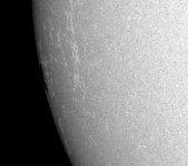
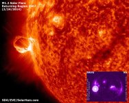
Now back for the third time around, it looks like a portion of the large dark core belonging to 1967 did survive the trip and is now emerging off the east limb. The formerly large active region continues to produce C-Class and lower level M-Class solar flares. An M1.2 flare was detected at 11:17 UTC Monday morning. Despite appearing to be in an advanced state of decay, there will remain a chance for isolated solar flares. Image below by SDO/HMI.

feb24_2014_1967.jpgfeb24_2014_m1.2.jpg
 

heaven1

مدیر بخش هواشناسی
Winter Won't Give Up: Bitterly Cold Finish to February


By: By Chris Dolce
Published: February 24, 2014


The start of March is a week away, so visions of shedding your heavy coat and placing it into storage might be entering your mind.
Unfortunately, the weather pattern for the final week of February won't cooperate with that thought process, particularly if you live along the northern tier of the United States.
Winter's Frigid Temperatures Hang On


It's a weather pattern that residents of the central and eastern states are very familiar with this winter, and also probably frustrated with.
Once again the polar jet stream will plunge southward, tapping bitter cold air directly from the Arctic Ocean. The latest frigid plunge will push into the nation's northern tier through most of the week. And by the middle of the week, much of the South will join in on the shivering, as well.
Let's step through the details of the forecast.

  • Where: Below-average temperatures will spill eastward into the Northeast on Monday, before making a more dramatic southward plunge Tuesday through Thursday. By Wednesday, much of the Midwest, South and Northeast will see temperatures 10 to 30 degrees colder than late-February averages. Some daily record low temperatures could be threatened in the Midwest on Wednesday morning and Friday morning.
  • Midwest Region Details: High temperatures in the single digits and teens will dominate from eastern Montana through the Upper Midwest to parts of the Great Lakes; subzero highs will return to parts of the Upper Midwest at times, especially Thursday. Lows will be in the single digits above and below zero. However, teens or 20s below zero are likely near the Canadian border (North Dakota, northern Minnesota, northern Wisconsin, the U.P. of Michigan). Teens below zero may surge as far south as northern Iowa on Wednesday and Friday. Wind chills at times this week will be in the teens, 20s and 30s below zero from the northern Plains to the Upper Mississippi Valley and Great Lakes.
  • City Forecasts: Chicago | Detroit |Fargo, N.D. | Minneapolis | St. Louis |Your Location
  • Northeast Region Details: Highs will be in the 20s and 30s along the I-95 corridor from Boston to Philadelphia much of this week. Lows may fall into the teens by late week. Elsewhere, highs in the teens and 20s will take over locations from northern New England to western New York and eventually western Pennsylvania.
  • City Forecasts: Burlington, Vt. | Boston | Buffalo | New York | Philadelphia | Your Location
  • South Region Details: Highs in the 40s and 50s will take over a large part of the South by Wednesday. Some 30s are possible in the Mid-South and southern Appalachians. Widespread lows in the 20s and 30s building into the Mid-South and Southern Plains Wednesday, then spreading into the Deep South and Carolinas by Thursday morning, lingering into Friday morning. Below-freezing low temperatures may reach the Gulf Coast of Mississippi and Alabama Thursday morning.
  • City Forecasts: Atlanta | Charlotte | Dallas | Little Rock | Nashville | Your Location
As we enter the first week of March, the latest long-range outlook from NOAA's Climate Prediction Center shows that below-average temperatures may continue across much of the country east of the Rockies.
How Cold Has this Winter Been?

According to NOAA, the overall temperature for the Lower 48 in January was near average. This is because we had above-average warmth in the West balancing out the well below-average temperatures east of the Rockies. A total of 18 states from Michigan and Wisconsin to the Southeast recorded a top 15 coldest January.
62dacdb4-257b-4acd-9451-06d88d394cc5_320x180.jpg
February 2014

Departure from average temperatures Feb. 1 to Feb. 22, 2014. Darker blue and purple shaded areas in the Midwest have had temperatures the farthest below average. Image credit: NOAA


Below-average temperatures have dominated much of February as well from parts of the Midwest and Plains to the Northeast. This is illustrated by the graphic to the right which shows locations the farthest below average in the dark blue and purple shadings over the Midwest.
In fact, several cities in the Midwest have seen a top 15 coldest February based on the monthly average temperature through Feb. 23, including Chicago, Green Bay, Wis. Dubuque, Iowa. and Moline, Ill.
Duluth, Minn. has already broken its record of 60 days with subzero lows this winter, including a record streak of 23 straight days with subzero lows from January 20 through February 11.
Green Bay, Wis. is also nearing its record number of days with subzero lows in any winter season, 48 days in 1976-77. The tally stands at 45 days through February 23.
For Minneapolis-St. Paul, the coming cold spell will likely push the Twin Cities into the top 10 for the most subzero temperatures ever recorded in a season. Through Feb. 243, temperatures have been subzero on 43 days this winter. Only two more subzero days are needed to push them into a tie for 10th place. Six more subzero days would tie for fifth place.
Conversely, above-average temperatures have dominated parts of Nevada, Utah, Arizona, New Mexico and California.
Of course, eastern North America accounts only for a small part the globe. When looking at the bigger picture, January was Earth's fourth warmest on record dating to 1880, according to a report from NOAA. This past December was the third warmest on record.
MORE: Most Extreme Temperatures in Each State


1 / 50


#50: Hawaii

55969979-66ee-429d-af78-b96304e34cc8_650x366.jpg


Hawaii has the nation's narrowest temperature range of any state thanks to is tropical location surrounded by water. The state record high was set in April 1931, and the state record low was set in May 1979 at an elevation of 13,733


heaven1

مدیر بخش هواشناسی
باز آپدیت جدید جی اف اس داغون شد

البته نه خیلی
جالبه امشب هم واسه مشهد بارش زده
 

Amir Mohsen

متخصص بخش هواشناسی
سلام دوستان

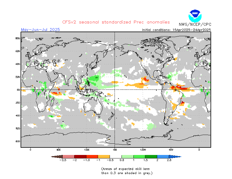
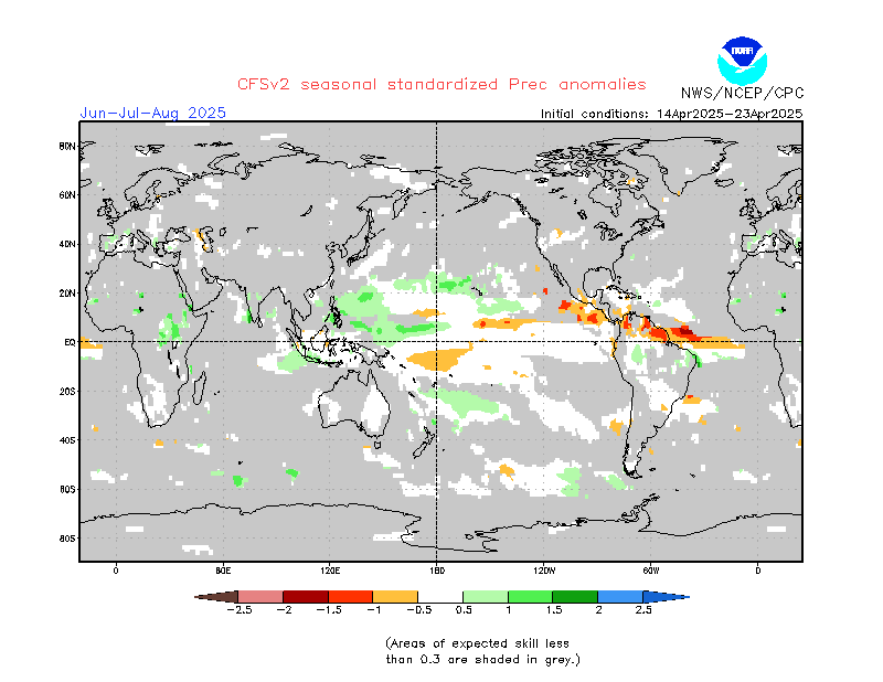
آپدیت ساعت 00:00 امروز نقشه های CFSV2

CFSv2.Prec.20140224.201403.gif


CFSv2.T2m.20140224.201403.gif


خوب در همین لحظه آپدیت ساعت 06:00 این نقشه ها هم صادر شد

و باز هم شدت سرما درنقشه های ماه مارچ و همچنین 8 روز اول ماه آپریل تشدید شد!

در ضمن وضع بارشهای شمال شرق هم بهبود پیدا کرده خدا رو شکر.

بنظرم دیگه سرد شدن دما در ماه مذکور در منطقه خاورمیانه رو قطعی بدونیم
 
آخرین ویرایش توسط مدیر:

seyyedalireza

مدیر موقت
نروژ برای مشهد زده
DateTimeForecast Temp. PrecipitationWind
Wednesday 26/02/2014 00:00–06:00
01n.89.png
-2°0 mm
vindstille.png
Calm, 0 m/s
06:00–12:00
01d.png
-3°0 mm
vindpil.0025.285.png
Light air, 2 m/s from west-northwest
12:00–18:00
01d.png
0 mm
vindpil.0025.075.png
Light air, 2 m/s from east-northeast
18:00–00:00
01n.89.png
0 mm
vindpil.0025.155.png
Light breeze, 4 m/s from south-southeast
Thursday 27/02/2014 00:00–06:00
01n.92.png
-1°0 mm
vindpil.0000.280.png
Light air, 1 m/s from west-northwest
06:00–12:00
01d.png
-1°0 mm
vindpil.0000.265.png
Light air, 1 m/s from west
12:00–18:00
01d.png
11°0 mm
vindpil.0025.090.png
Light air, 2 m/s from east
18:00–00:00
01n.92.png
0 mm
vindpil.0025.160.png
Light breeze, 3 m/s from south-southeast
Friday 28/02/2014 21:00–03:00
01n.96.png
0 mm
vindpil.0025.215.png
Light breeze, 2 m/s from southwest
03:00–09:00
01d.png
0 mm
vindpil.0025.275.png
Light air, 2 m/s from west
09:00–15:00
01d.png
0 mm
vindpil.0000.080.png
Light air, 1 m/s from east
15:00–21:00
04.png
13°0 mm
vindpil.0025.110.png
Light breeze, 3 m/s from east-southeast
Saturday 01/03/2014 21:00–03:00
03n.99.png
0 mm
vindpil.0025.210.png
Light air, 2 m/s from south-southwest
03:00–09:00
04.png
0 mm
vindpil.0025.270.png
Light air, 2 m/s from west
09:00–15:00
04.png
0 mm
vindpil.0025.025.png
Light air, 2 m/s from north-northeast
15:00–21:00
04.png
11°0 mm
vindpil.0050.120.png
Gentle breeze, 5 m/s from east-southeast
Sunday 02/03/2014 21:00–03:00
02n.02.png
0 mm
vindpil.0025.180.png
Light breeze, 3 m/s from south
03:00–09:00
01d.png
0 mm
vindpil.0000.240.png
Light air, 1 m/s from west-southwest
09:00–15:00
02d.png
0 mm
vindpil.0025.085.png
Light air, 2 m/s from east
15:00–21:00
01n.02.png
14°0 mm
vindpil.0050.095.png
Gentle breeze, 4 m/s from east
Monday 03/03/2014 21:00–03:00
03n.06.png
0 mm
vindpil.0025.195.png
Light breeze, 2 m/s from south-southwest
03:00–09:00
03d.png
0 mm
vindpil.0025.280.png
Light air, 2 m/s from west
09:00–15:00
04.png
11°0 mm
vindpil.0025.100.png
Light air, 2 m/s from east
15:00–21:00
04.png
16°0 mm
vindpil.0050.105.png
Gentle breeze, 4 m/s from east-southeast
Tuesday 04/03/2014 21:00–03:00
04.png
11°0 mm
vindpil.0000.255.png
Light air, 1 m/s from west-southwest
03:00–09:00
04.png
0.2 mm
vindpil.0025.275.png
Light air, 2 m/s from west
09:00–15:00
09.png
12°1.4 mm
vindpil.0000.315.png
Light air, 1 m/s from northwest
15:00–21:00
09.png
13°2.2 mm
vindpil.0000.170.png
Light air, 1 m/s from south
Wednesday 05/03/2014 21:00–03:00
03n.13.png
0 mm
vindpil.0000.255.png
Light air, 1 m/s from west-southwest
03:00–09:00
03d.png
0 mm
vindpil.0025.275.png
Light air, 2 m/s from west
09:00–15:00
09.png
10°0.6 mm
vindpil.0025.020.png
Light air, 2 m/s from north-northeast
15:00–21:00
05n.13.png
14°3.2 mm
vindpil.0000.155.png
Light air, 1 m/s from south-southeast
Thursday 06/03/2014 21:00–03:00
01n.16.png
0 mm
vindpil.0000.230.png
Light air, 1 m/s from southwest
03:00–09:00
01d.png
0 mm
vindpil.0000.250.png
Light air, 1 m/s from west-southwest
09:00–15:00
01d.png
11°0.2 mm
vindpil.0000.070.png
Light air, 1 m/s from east-northeast
15:00–21:00
03n.16.png
16°0 mm
vindpil.0025.075.png
Light breeze, 3 m/s from east-northeast
Friday 07/03/2014 21:00–03:00
01n.19.png
0 mm
vindpil.0025.175.png
Light air, 2 m/s from south
Detailed long term forecast
 
وضعیت
موضوع بسته شده است.
بالا