-
توجه: در صورتی که از کاربران قدیمی ایران انجمن هستید و امکان ورود به سایت را ندارید، میتوانید با آیدی altin_admin@ در تلگرام تماس حاصل نمایید.
You are using an out of date browser. It may not display this or other websites correctly.
You should upgrade or use an alternative browser.
You should upgrade or use an alternative browser.
مباحث عمومی هواشناسی
- شروع کننده موضوع Amir Mohsen
- تاریخ شروع
- وضعیت
- موضوع بسته شده است.
92 ناهنجار
Banned
92 ناهنجار
Banned
92 ناهنجار
Banned
92 ناهنجار
Banned
92 ناهنجار
Banned
92 ناهنجار
Banned
92 ناهنجار
Banned
aliasgar57
کاربر ويژه
خدایا!
حکومت کشور جان با توست! به غیر وامگذار.
خدایا! باغبانی این باغ را به کس مسپار که اگر جز شیره مهر تو در آوندهای این باغ بدود برگها به پژمردگی خواهد نشست و اگر جز باران محبت تو بر این باغ ببارد پرچمهای باغ فرو خواهد افتاد و اگر جز نسیم لطف تو به این بوستان بوزد غنچه ها خواهند مرد.
خدایا!
سنگهای گناهان ما را از دهان چشمه های موهبت خویش کنار بزن و دلهای ما را سیراب زلال مهر خویش گردان.
سلام دوستان ببخشید که ربطی به موضوع هواشناسی ندارد:گل:
مشهد
[TH]Thursday28 March[/TH]
[TH]Friday29 March[/TH]
[TH="class: weekend, bgcolor: #ADD4E4"]Saturday30 March[/TH]
[TH="class: weekend, bgcolor: #ADD4E4"]Sunday31 March[/TH]
[TH]Monday01 April[/TH]
[TH]Tuesday02 April[/TH]
[TH]Wednesday03 April[/TH]
[TH]Thursday04 April[/TH]
[TR]
[TD]
 [/TD]
[/TD]
[TD]
 [/TD]
[/TD]
[TD]
 [/TD]
[/TD]
[TD]
 [/TD]
[/TD]
[TD]
 [/TD]
[/TD]
[TD]
 [/TD]
[/TD]
[TD]
 [/TD]
[/TD]
[TD]
 [/TD]
[/TD]
[TD]
 [/TD]
[/TD]
[/TR]
[TR]
[TD="class: temperature plus"]17°[/TD]
[TD="class: temperature plus"]23°[/TD]
[TD="class: temperature plus"]18°[/TD]
[TD="class: temperature plus"]20°[/TD]
[TD="class: temperature plus"]11°[/TD]
[TD="class: temperature plus"]13°[/TD]
[TD="class: temperature plus"]12°[/TD]
[TD="class: temperature plus"]15°[/TD]
[TD="class: temperature plus"]19°[/TD]
[/TR]
[TR]
[TD]0 mm precipitation per 24 hours[/TD]
[TD]0 mm precipitation per 24 hours[/TD]
[TD]0 mm precipitation per 24 hours[/TD]
[TD]4.5 mm precipitation per 24 hours[/TD]
[TD]0.4 mm precipitation per 24 hours[/TD]
[TD]0 mm precipitation per 24 hours[/TD]
[TD]0 mm precipitation per 24 hours[/TD]
[TD]0 mm precipitation per 24 hours[/TD]
[TD]0 mm precipitation per 24 hours[/TD]
[/TR]
[TR]
[TD]
 [/TD]
[/TD]
[TD]
 [/TD]
[/TD]
[TD]
 [/TD]
[/TD]
[TD]
 [/TD]
[/TD]
[TD]
 [/TD]
[/TD]
[TD]
 [/TD]
[/TD]
[TD]
 [/TD]
[/TD]
[TD]
 [/TD]
[/TD]
[TD]

[/TD]
[/TR]
| Wednesday27 March |
|---|
[TH]Thursday28 March[/TH]
[TH]Friday29 March[/TH]
[TH="class: weekend, bgcolor: #ADD4E4"]Saturday30 March[/TH]
[TH="class: weekend, bgcolor: #ADD4E4"]Sunday31 March[/TH]
[TH]Monday01 April[/TH]
[TH]Tuesday02 April[/TH]
[TH]Wednesday03 April[/TH]
[TH]Thursday04 April[/TH]
[TR]
[TD]

[TD]

[TD]

[TD]

[TD]

[TD]

[TD]

[TD]

[TD]

[/TR]
[TR]
[TD="class: temperature plus"]17°[/TD]
[TD="class: temperature plus"]23°[/TD]
[TD="class: temperature plus"]18°[/TD]
[TD="class: temperature plus"]20°[/TD]
[TD="class: temperature plus"]11°[/TD]
[TD="class: temperature plus"]13°[/TD]
[TD="class: temperature plus"]12°[/TD]
[TD="class: temperature plus"]15°[/TD]
[TD="class: temperature plus"]19°[/TD]
[/TR]
[TR]
[TD]0 mm precipitation per 24 hours[/TD]
[TD]0 mm precipitation per 24 hours[/TD]
[TD]0 mm precipitation per 24 hours[/TD]
[TD]4.5 mm precipitation per 24 hours[/TD]
[TD]0.4 mm precipitation per 24 hours[/TD]
[TD]0 mm precipitation per 24 hours[/TD]
[TD]0 mm precipitation per 24 hours[/TD]
[TD]0 mm precipitation per 24 hours[/TD]
[TD]0 mm precipitation per 24 hours[/TD]
[/TR]
[TR]
[TD]

[TD]

[TD]

[TD]

[TD]

[TD]

[TD]

[TD]

[TD]

[/TD]
[/TR]
92 ناهنجار
Banned
با سلام. پوشش و ارتفاع برف چهارشنبه 19 دی 1386:

The Snow Analysis used in the CFSR
Snow liquid equivalent depth was updated using analysis data from the Air Force Weather Agency’s SNODEP model (Kopp et al. 1996) and the NESDIS Interactive Multisensor Snow and Ice Mapping System (IMS) (Helfrich et al. 2007). SNODEP uses in situ observations, an SSM/I-based detection algorithm, and its own climatology to produce a global analysis of physical snow depth once per day at 47 km resolution. Analysts may further adjust the analysis. SNODEP has been operational since 1975 and its data were available for the entire reanalysis period. The IMS data is a manually generated northern hemisphere snow cover analysis produced once per day. Analysts use surface data, geostationary and polar orbiting imagery, and microwave-based detection algorithms to determine whether an area is either snow covered or snow free. IMS data were available at 23 km resolution starting February 1997 and at 4 km resolution starting February 2004.
ایرج جان دقیقن در زمان های مثبت بودن این شاخص سرمای خوبی در شمال شرق اتفاق افتاده دقیقن وضعیتی که در اواخر دسامبر و ژانویه داشتیم ولی بقیه کشور را نمیدونم ولی دقیقن منفی بودن این شاخص خیلی واسه شمال شرق بده!!! وضعیتی که تقریبن در بهمن امسال داشتیم و با NAO منفی با گرمای بی سابقه ای روبرو شدیم هرچند که بقیه کشور هم اینطور بود!!!
درود
هادی جان من یکی که واقعا کلافه شدم بعد از سال 85 منطقه زاگرس و غرب کشور با خشکسالی دست و پنجه نرم میکنه و خدا میدونه این خشکسالی کی تموم میشه (خدا کنه ****************** :راز: این خشکسالی هم بره) این که میبینم روزها یکی پس از دیگری بدون پدیده خاصی سپری میشه و بارشی رخ نمیده و 2 ماه بیشترم وقت نداریم دود از سرم بلند میشه
آخرین ویرایش توسط مدیر:
22 بهمن 1383 هم زمان با برف سنگین رشت:
سال 83 یکی از زیباترین سالهای زندگی من بود برف و سرمای بیسابقه
92 ناهنجار
Banned
تصاویر زیر مربوط به روز شنبه 11 جمادى الاولى 1434هـ میباشد که از کشور عربستان به دست اینجانب رسیده است:
کاملا با شکوه و با عظمت است...
قال تعالى "هُوَ الَّذِي يُرِيكُمُ الْبَرْقَ خَوْفًا وَطَمَعًا وَيُنْشِئُ السَّحَابَ الثِّقَالَ (12)" الرعد.


کاملا با شکوه و با عظمت است...
قال تعالى "هُوَ الَّذِي يُرِيكُمُ الْبَرْقَ خَوْفًا وَطَمَعًا وَيُنْشِئُ السَّحَابَ الثِّقَالَ (12)" الرعد.


Amir Mohsen
متخصص بخش هواشناسی
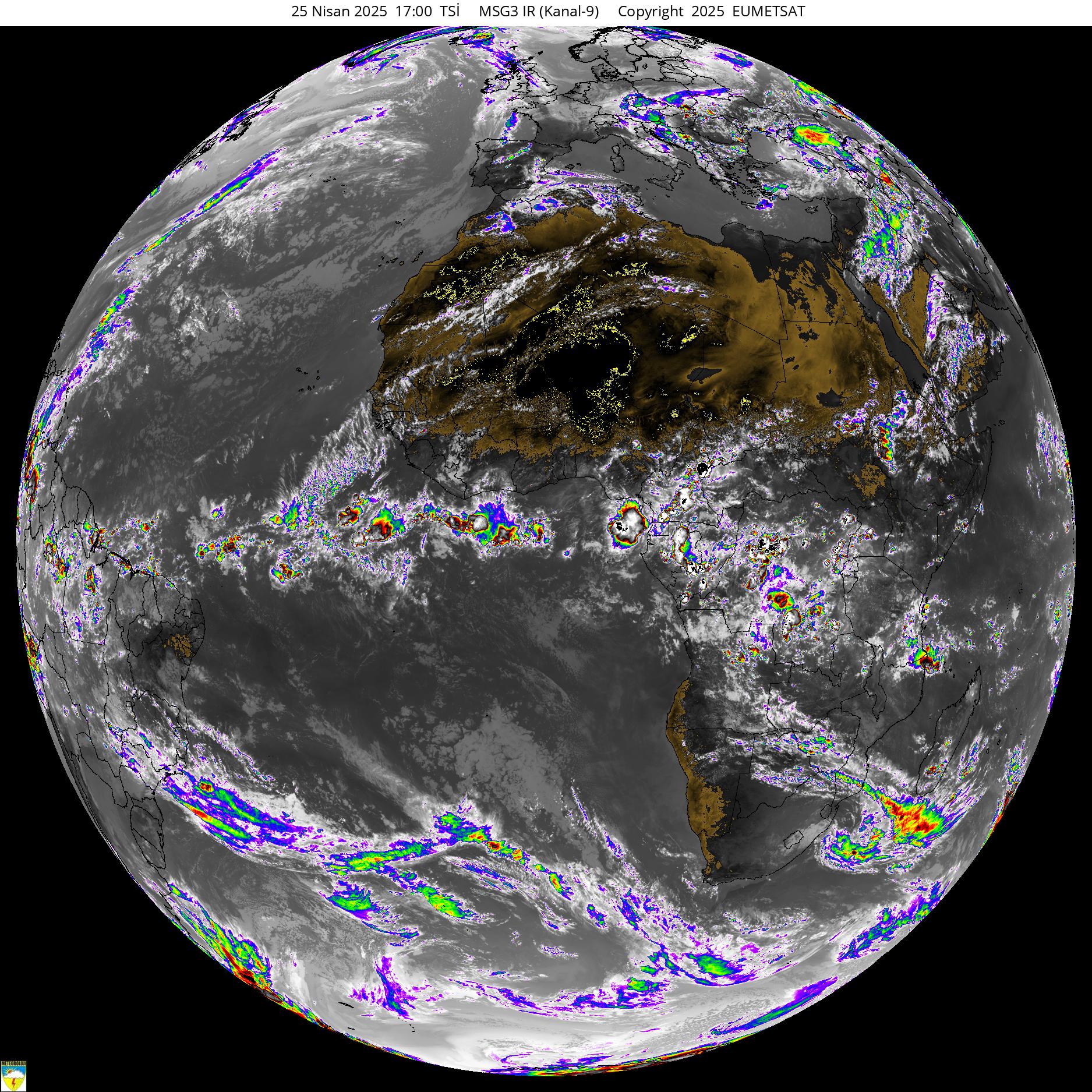
آخرین تصویر ماهواره ای واقعی با وضوح بالا:


سال 83 یکی از زیباترین سالهای زندگی من بود برف و سرمای بیسابقه
سنگین ترین بارش برف رشت که من به چشم دیدم هم با ارتفاع بیشتر از یک و نیم متر در بهمن 83 اتفاق افتاد. همیشه وقتی برف اومده خدا خدا کردم بند نیاد و بیشتر بشینه، ولی فکر کنم فقط اون سال بود که از خدا خواستم دیگه برف بند بیاد! آب و برق قطع شده بود. سقف خیلی از خونه ها شکست. با همه مشکلات در کل واسه منم برف زیبایی بود. چقدر زور زمان می گذره
- وضعیت
- موضوع بسته شده است.


