-
توجه: در صورتی که از کاربران قدیمی ایران انجمن هستید و امکان ورود به سایت را ندارید، میتوانید با آیدی altin_admin@ در تلگرام تماس حاصل نمایید.
You are using an out of date browser. It may not display this or other websites correctly.
You should upgrade or use an alternative browser.
You should upgrade or use an alternative browser.
تجزیه و تحلیل وضعیت جوی در سال زراعی 93-94 /فصل دوم( دي- بهمن-اسفند)
- شروع کننده موضوع heaven1
- تاریخ شروع
- وضعیت
- موضوع بسته شده است.
تو تصویر بارش بر حسب سانتیمتر مشخصه
seyyedalireza
مدیر موقت
انشالله ايندفه شرق مشهد و مرکز هم سپید پوش بشهدر منطقه ما بارش خفیف برف داریم فکر میکردم دیرتر شروع بشه
seyyedalireza
مدیر موقت
مرکز مشهد بارش بسیار خفیف برف داریم ولی برفش ریز نيستش
Amir Mohsen
متخصص بخش هواشناسی
بارش برف نسبتا شدید در گردنه تیوان


| * گزارش مقدماتی؛ پارامترهای زمینلرزه پس ازبازبینی تغییر خواهند کرد. |
| زمان وقوع به وقت محلي | بزرگي | عرض جغرافيايي (درجه - شمالی) |
[TD="class: farsi_text_r, width: 80, align: center"]طول جغرافيايي
(درجه - شرقی)[/TD]
[TD="class: farsi_text_r, width: 50, align: center"]عمق
(کیلومتر)[/TD]
[TD="class: farsi_text_r, align: center"]منطقه[/TD]
[TR="class: DataRow1_F"]
[TD]۱۳۹۳-۱۱-۰۵ ۲۳:۴۱:۱۹.۳[/TD]
[TD]۵.۰[/TD]
[TD]۲۷.۴۴۳[/TD]
[TD]۵۶.۱۶۳[/TD]
[TD]۸[/TD]
[TD] بندرعباس، هرمزگان *[/TD]
[/TR]
[TR="class: DataRow2_F"]
[TD]۱۳۹۳-۱۱-۰۵ ۲۳:۰۷:۵۲.۳[/TD]
[TD]۲.۴[/TD]
[TD]۳۱.۵۰۴[/TD]
[TD]۵۵.۱۴۳[/TD]
[TD]۶[/TD]
[TD] بافق، يزد[/TD]
[/TR]
[TR="class: DataRow1_F"]
[TD]۱۳۹۳-۱۱-۰۵ ۲۳:۰۲:۱۰.۱[/TD]
[TD]۱.۳[/TD]
[TD]۳۶.۲۵۷[/TD]
[TD]۵۲.۴۲۴[/TD]
[TD]۱۰[/TD]
[TD] خوش رود پی، مازندران[/TD]
[/TR]
[TR="class: DataRow2_F"]
[TD]۱۳۹۳-۱۱-۰۵ ۲۲:۰۷:۴۸.۸[/TD]
[TD]۱.۴[/TD]
[TD]۳۵.۹۶۳[/TD]
[TD]۵۲.۴۴۳[/TD]
[TD]۱۰[/TD]
[TD] آلاشت، مازندران[/TD]
[/TR]
[TR="class: DataRow1_F"]
[TD]۱۳۹۳-۱۱-۰۵ ۲۱:۰۱:۱۶.۹[/TD]
[TD]۱.۲[/TD]
[TD]۳۵.۷۸۰[/TD]
[TD]۵۲.۷۶۲[/TD]
[TD]۱۰[/TD]
[TD] فيروزكوه، تهران[/TD]
[/TR]
[TR="class: DataRow2_F"]
[TD]۱۳۹۳-۱۱-۰۵ ۱۹:۴۸:۳۶.۵[/TD]
[TD]۱.۷[/TD]
[TD]۲۹.۱۱۶[/TD]
[TD]۵۷.۵۴۴[/TD]
[TD]۱۰[/TD]
[TD] درب بهشت، کرمان[/TD]
[/TR]
[TR="class: DataRow1_F"]
[TD]۱۳۹۳-۱۱-۰۵ ۱۹:۳۳:۴۸.۹[/TD]
[TD]۱.۶[/TD]
[TD]۲۹.۱۰۸[/TD]
[TD]۵۸.۳۸۲[/TD]
[TD]۱۰[/TD]
[TD] بم، كرمان[/TD]
[/TR]
[TR="class: DataRow2_F"]
[TD]۱۳۹۳-۱۱-۰۵ ۱۹:۱۴:۱۱.۸[/TD]
[TD]۲.۷[/TD]
[TD]۳۲.۶۹۱[/TD]
[TD]۴۷.۷۸۴[/TD]
[TD]۱۰[/TD]
[TD] مورموري، ايلام[/TD]
[/TR]
[TR="class: DataRow1_F"]
[TD]۱۳۹۳-۱۱-۰۵ ۱۸:۴۸:۵۰.۰[/TD]
[TD]۱.۵[/TD]
[TD]۳۷.۰۱۳[/TD]
[TD]۵۸.۶۳۰[/TD]
[TD]۱۰[/TD]
[TD] قوچان، خراسان رضوي[/TD]
[/TR]
[TR="class: DataRow2_F"]
[TD]۱۳۹۳-۱۱-۰۵ ۱۸:۳۸:۵۵.۷[/TD]
[TD]۱.۹[/TD]
[TD]۳۱.۷۹۹[/TD]
[TD]۵۹.۶۴۸[/TD]
[TD]۵[/TD]
[TD] نهبندان، خراسان جنوبی[/TD]
[/TR]
[TR="class: DataRow1_F"]
[TD]۱۳۹۳-۱۱-۰۵ ۱۶:۳۵:۲۲.۵[/TD]
[TD]۱.۷[/TD]
[TD]۳۵.۲۱۰[/TD]
[TD]۵۰.۴۰۵[/TD]
[TD]۱۰[/TD]
[TD] مامونيه، مركزي[/TD]
[/TR]
[TR="class: DataRow2_F"]
[TD]۱۳۹۳-۱۱-۰۵ ۱۶:۲۸:۲۰.۷[/TD]
[TD]۱.۶[/TD]
[TD]۳۴.۸۰۴[/TD]
[TD]۴۸.۶۹۱[/TD]
[TD]۱۰[/TD]
[TD] جورقان، همدان[/TD]
[/TR]
[TR="class: DataRow1_F"]
[TD]۱۳۹۳-۱۱-۰۵ ۱۶:۰۸:۵۰.۹[/TD]
[TD]۲.۱[/TD]
[TD]۳۵.۱۹۲[/TD]
[TD]۵۰.۴۱۱[/TD]
[TD]۸[/TD]
[TD] مامونيه، مركزي[/TD]
[/TR]
[TR="class: DataRow2_F"]
[TD]۱۳۹۳-۱۱-۰۵ ۱۵:۰۴:۵۶.۳[/TD]
[TD]۱.۹[/TD]
[TD]۳۵.۸۴۳[/TD]
[TD]۵۲.۷۲۴[/TD]
[TD]۱۲[/TD]
[TD] فيروزكوه، تهران[/TD]
[/TR]
[TR="class: DataRow1_F"]
[TD]۱۳۹۳-۱۱-۰۵ ۱۴:۵۱:۲۲.۵[/TD]
[TD]۲.۸[/TD]
[TD]۲۸.۴۱۹[/TD]
[TD]۵۳.۳۳۴[/TD]
[TD]۷[/TD]
[TD] فتح آباد، فارس[/TD]
[/TR]
[TR="class: DataRow2_F"]
[TD]۱۳۹۳-۱۱-۰۵ ۱۴:۴۶:۴۳.۶[/TD]
[TD]۲.۲[/TD]
[TD]۳۴.۷۴۵[/TD]
[TD]۵۳.۸۸۴[/TD]
[TD]۱۰[/TD]
[TD] باراندازميانه، سمنان[/TD]
[/TR]
[TR="class: DataRow1_F"]
[TD]۱۳۹۳-۱۱-۰۵ ۱۴:۴۴:۴۴.۵[/TD]
[TD]۱.۷[/TD]
[TD]۳۸.۳۸۵[/TD]
[TD]۴۶.۶۱۶[/TD]
[TD]۱۰[/TD]
[TD] ورزقان، آذربايجان شرقي[/TD]
[/TR]
[TR="class: DataRow2_F"]
[TD]۱۳۹۳-۱۱-۰۵ ۱۴:۴۲:۳۴.۵[/TD]
[TD]۱.۷[/TD]
[TD]۲۹.۸۶۷[/TD]
[TD]۵۵.۸۹۰[/TD]
[TD]۱۰[/TD]
[TD] پاريز، کرمان[/TD]
[/TR]
[TR="class: DataRow1_F"]
[TD]۱۳۹۳-۱۱-۰۵ ۱۴:۲۸:۵۰.۸[/TD]
[TD]۲.۲[/TD]
[TD]۳۶.۶۶۷[/TD]
[TD]۴۷.۵۳۸[/TD]
[TD]۱۰[/TD]
[TD] ماه نشان، زنجان[/TD]
[/TR]
[TR="class: DataRow2_F"]
[TD]۱۳۹۳-۱۱-۰۵ ۱۳:۵۴:۲۳.۷[/TD]
[TD]۱.۲[/TD]
[TD]۲۹.۶۱۷[/TD]
[TD]۵۶.۷۰۸[/TD]
[TD]۱۰[/TD]
[TD] نگار، کرمان[/TD]
[/TR]
Mohammad900
New member
سلام
شمال کی برف میاد؟ اپدیتها مناسب هستن؟!
بعدش کی ایشالله پرفشار سیبری با مدیترانه ای باهم ادغام میشن آیا امیدی بهش در ادامه زمستون هست یا نه . متشکرم
شمال کی برف میاد؟ اپدیتها مناسب هستن؟!
بعدش کی ایشالله پرفشار سیبری با مدیترانه ای باهم ادغام میشن آیا امیدی بهش در ادامه زمستون هست یا نه . متشکرم
Mohammad900
New member
اینجا که از ایتدای دی تا به حال بارشها مزخرف بوده

Mohammad900
New member
Britain on RED alert: 'Displaced polar vortex' to unleash crippling snowstorms next week[h=3]BRITAIN is on RED ALERT for a devastating “displaced Polar vortex” to unleash nationwide snowstorms IN DAYS.Published: 15:26, Sun, January 25, 2015By NATHAN RAO
 [COLOR=#FFFFFF !important]NET WEATHER/GETTY
The 'displaced Polar vortex' will wreak weather havoc across the UK Panicked forecasters raised the alert in the past hour after spotting the freak system on the weather models.
Rare in the UK it is identical to the phenomenon which triggered crippling whiteouts and ice storms in the United States.
Sparked by the frenzied and volatile behaviour of the jet stream it threatens to bring the fury of the North Pole tearing across the country NEXT WEEK.
Forecasters say temperatures will plunge to below -15C (5F) while feet-deep snow drifts on a par with the worst winters in history are likely.
The whole of the UK will be scourged by screaming Arctic gales and blizzards right through the first half of February.
 [COLOR=#FFFFFF !important]The Jet Stream plunging southwards towards the beginning of next week [NET WEATHER][/COLOR]
A repeat of the historic freeze of 2010 which brought the coldest temperatures on record and ground airports to a standstill, is feared.
Weather experts say they have issued a stark warning to emergency services and the Government to take action now.
Airports, railway lines and roads are expected to grind to a shivering halt with extreme cold threatening the lives of thousands of people.
Piers Corbyn, forecaster for WeatherAction, warned a “catastrophic” set of circumstances have come together to trigger a lethal spell of weather.
He said: “This could lead to anything, gales, huge snowstorms and the lowest temperatures of winter so far.
“Such is the severity of this situation I have written to the Government’s Cabinet Office Briefing Room (COBRA) committee urging them to take immediate action.”
The terrifying prediction is the result of a deeply meandering jet stream which has been largely responsible for the erratic weather this winter.
At the start of the season forecasters warned this big freeze would hit towards the end of December, but the frenzied deviation of the jet stream nudged it out of the way.
The fast-flowing band of air is now poised to shift to a much more southerly position allowing the contents of the North Pole to flood into the UK.
 [COLOR=#FFFFFF !important]GETTY[/COLOR]
A wild horse makes its way across snow covered fields on Divis mountain in Belfast, Northern IrelandSwathes of the UK face knee-deep snow drifts with roads set to turn into deadly ice rinks sparking travel chaos.
Mr Corbyn said: “This is going to be a severely damaging spell of weather, the NHS is thoroughly unprepared and has been lucky up until now as it has not been too severe.
“But this is about to change dramatically with a displaced Polar vortex likely to dominate the weather for the first half of next month.”
Weather charts show the jet stream violently churning across the Atlantic, sweeping in dips and troughs over the UK.
It has been travelling unusually fast resulting in the storms being pulled in from the Atlantic at the beginning of the year.
 [COLOR=#FFFFFF !important]GETTY[/COLOR]
A car is abandoned due to the hazardous weather conditions in Scotland Forecasters warn it is cranking up a gear again threatening more wind and rain this week before whipping freezing cold air down from the Arctic region.
James Madden, forecaster for Exacta Weather, said the entire country could be blanketed in a carpet of snow by the end of next week.
He explained the chaotic winter surge is being bolstered by a strong negative Arctic Oscillation AO.
The AO describes the pattern of air flow around the northern hemisphere, when a negative phase it pulls Arctic air towards the UK.
Mr Madden said after this sets in the country will be plunged into a lengthy and severe big freeze.
 [COLOR=#FFFFFF !important]GETTY[/COLOR]
Extreme frost hits Richmond Park in London He said: “We are now about to enter a significant and prolonged pattern change to even colder conditions, which will also be accompanied by frequent and widespread snow events across the whole country.
“From the middle part of next week cold air of an Arctic origin will begin to surge in across the whole of the country.
“This will also bring the risk of almost nationwide snow showers.
“The cold and wintry theme will also remain as the more dominant feature over the next several weeks at the very least, and it will tighten its grip even more and gradually worsen throughout February as a strong blocking pattern develops.
 [COLOR=#FFFFFF !important]GETTY[/COLOR]
A man walks along the snow-covered path of the Huddersfield Narrow Canal in the village of Marsden “The final part of January and February period is now shaping up to something that could be on a similar par to December 2010 at the very least.
“There is likely to be frequent and heavy bouts of snow across the whole country, severe blizzards, and major ice problems.”
The Met Office warned of widespread wintry showers as temperatures plummet close to -10C (14F) by the end of the week.
Forecaster Calum MacColl said tomorrow and Tuesday will stay mild before the cold snap bites on Wednesday.
 [COLOR=#FFFFFF !important]GETTY[/COLOR]
Difficult driving conditions cause this lorry to slide off the road in Tyndrum, Scotland He said freezing winds from Greenland and Canada will make it feel even colder with snow and widespread frosts on the cards.
He said: “From Wednesday onwards we are back into a cold snap which will initially last five or six days.
“Winds from the north will see wintry showers picking up with snow right through to low levels later in the week.
[/COLOR]
|
|
|
|
|
|

The 'displaced Polar vortex' will wreak weather havoc across the UK Panicked forecasters raised the alert in the past hour after spotting the freak system on the weather models.
Rare in the UK it is identical to the phenomenon which triggered crippling whiteouts and ice storms in the United States.
Sparked by the frenzied and volatile behaviour of the jet stream it threatens to bring the fury of the North Pole tearing across the country NEXT WEEK.
Forecasters say temperatures will plunge to below -15C (5F) while feet-deep snow drifts on a par with the worst winters in history are likely.
The whole of the UK will be scourged by screaming Arctic gales and blizzards right through the first half of February.

A repeat of the historic freeze of 2010 which brought the coldest temperatures on record and ground airports to a standstill, is feared.
Weather experts say they have issued a stark warning to emergency services and the Government to take action now.
Airports, railway lines and roads are expected to grind to a shivering halt with extreme cold threatening the lives of thousands of people.
Piers Corbyn, forecaster for WeatherAction, warned a “catastrophic” set of circumstances have come together to trigger a lethal spell of weather.
He said: “This could lead to anything, gales, huge snowstorms and the lowest temperatures of winter so far.
This could lead to anything, gales, huge snowstorms and the lowest temperatures of winter so far
Piers Corbyn, forecaster
“We are now 95 per cent certain that the whole of the country will be affected from the start of February.Piers Corbyn, forecaster
“Such is the severity of this situation I have written to the Government’s Cabinet Office Briefing Room (COBRA) committee urging them to take immediate action.”
The terrifying prediction is the result of a deeply meandering jet stream which has been largely responsible for the erratic weather this winter.
At the start of the season forecasters warned this big freeze would hit towards the end of December, but the frenzied deviation of the jet stream nudged it out of the way.
The fast-flowing band of air is now poised to shift to a much more southerly position allowing the contents of the North Pole to flood into the UK.

A wild horse makes its way across snow covered fields on Divis mountain in Belfast, Northern IrelandSwathes of the UK face knee-deep snow drifts with roads set to turn into deadly ice rinks sparking travel chaos.
Mr Corbyn said: “This is going to be a severely damaging spell of weather, the NHS is thoroughly unprepared and has been lucky up until now as it has not been too severe.
“But this is about to change dramatically with a displaced Polar vortex likely to dominate the weather for the first half of next month.”
Weather charts show the jet stream violently churning across the Atlantic, sweeping in dips and troughs over the UK.
It has been travelling unusually fast resulting in the storms being pulled in from the Atlantic at the beginning of the year.

A car is abandoned due to the hazardous weather conditions in Scotland Forecasters warn it is cranking up a gear again threatening more wind and rain this week before whipping freezing cold air down from the Arctic region.
James Madden, forecaster for Exacta Weather, said the entire country could be blanketed in a carpet of snow by the end of next week.
He explained the chaotic winter surge is being bolstered by a strong negative Arctic Oscillation AO.
The AO describes the pattern of air flow around the northern hemisphere, when a negative phase it pulls Arctic air towards the UK.
Mr Madden said after this sets in the country will be plunged into a lengthy and severe big freeze.

Extreme frost hits Richmond Park in London He said: “We are now about to enter a significant and prolonged pattern change to even colder conditions, which will also be accompanied by frequent and widespread snow events across the whole country.
“From the middle part of next week cold air of an Arctic origin will begin to surge in across the whole of the country.
“This will also bring the risk of almost nationwide snow showers.
“The cold and wintry theme will also remain as the more dominant feature over the next several weeks at the very least, and it will tighten its grip even more and gradually worsen throughout February as a strong blocking pattern develops.

A man walks along the snow-covered path of the Huddersfield Narrow Canal in the village of Marsden “The final part of January and February period is now shaping up to something that could be on a similar par to December 2010 at the very least.
“There is likely to be frequent and heavy bouts of snow across the whole country, severe blizzards, and major ice problems.”
The Met Office warned of widespread wintry showers as temperatures plummet close to -10C (14F) by the end of the week.
Forecaster Calum MacColl said tomorrow and Tuesday will stay mild before the cold snap bites on Wednesday.

Difficult driving conditions cause this lorry to slide off the road in Tyndrum, Scotland He said freezing winds from Greenland and Canada will make it feel even colder with snow and widespread frosts on the cards.
He said: “From Wednesday onwards we are back into a cold snap which will initially last five or six days.
“Winds from the north will see wintry showers picking up with snow right through to low levels later in the week.
[/COLOR]
Mohammad900
New member
وضعیت فشارها هم براتون بزارم ببینید آرایششرو که احتمالا میگه! وضع وخیمه!!


Ahmad77777
New member
پاشین چه برفی داره میاد.
جای خونه ما که کاملا سفید شده.
هنوزم داره میباره.
جای خونه ما که کاملا سفید شده.
هنوزم داره میباره.
Ahmad77777
New member
ببخشید از بس خوشحال و شوکه شدم یادم رفت سلام و صبح بخیر بگم.

بارش برف الآن شدیدتر شد.
من برم چندتا عکس بگیرم.
فعلا دوستان.
بارش برف الآن شدیدتر شد.
من برم چندتا عکس بگیرم.
فعلا دوستان.
Ahmad77777
New member

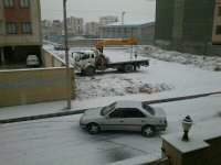
همین الآن....
Amir-Hossein
کاربر ويژه
پاشین چه برفی داره میاد.
جای خونه ما که کاملا سفید شده.
هنوزم داره میباره.
سلام دوستان عزیزم ، صبح کاملا برفی تون بخیرببخشید از بس خوشحال و شوکه شدم یادم رفت سلام و صبح بخیر بگم.
بارش برف الآن شدیدتر شد.
من برم چندتا عکس بگیرم.
فعلا دوستان.
احمد جان منم حسابی ذوق زده شدم...!
اینم کوچه ما همین لحظه...
Sent from my WT19i using Tapatalk
پیوست ها
Amir Mohsen
متخصص بخش هواشناسی
سلام و صبح بخیر.
تبریک بابت صبح برفی.
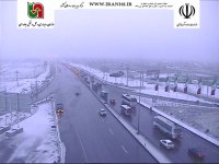
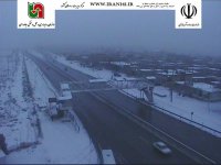
دوربینها از قوچان تا سرخس و نیشابور و مشهد و فریمان و سرخس رو برفی نشون میدن .خدا رو شکر
تبریک بابت صبح برفی.
دوربینها از قوچان تا سرخس و نیشابور و مشهد و فریمان و سرخس رو برفی نشون میدن .خدا رو شکر
- وضعیت
- موضوع بسته شده است.


