• توجه: در صورتی که از کاربران قدیمی ایران انجمن هستید و امکان ورود به سایت را ندارید، میتوانید با آیدی altin_admin@ در تلگرام تماس حاصل نمایید.

مباحث عمومی هواشناسی تابستان 1393

وضعیت
موضوع بسته شده است.

Amir Mohsen

متخصص بخش هواشناسی
سامانه ای که برای روز 10 اکتبر در نقشه ها دیده میشه همچنان بقوت خودش باقی هست ولی مختص نواحی شمالی آذربایجان و خصوصا سواحل غربی هست تا اینکه اگه خدا بخواد و اطلاعات فعلی محقق بشه در روزهای 14 و 15 اکتبر مجددا یک سامانه شمالی قویتر در بخشهای شمالی کشور فعال خواهد شد که خراسان شمالی و شمال خراسان رضوی و شهر مشهد هم بدون بهره نخواهد ماند:


bk5ptk2a2elcx48r1d5x.gif
 

samann

کاربر ويژه
این روزها هوای عصرها و صبح ها کاملا پاییزی است. گویی امسال پاییز زودتر از موعود به این سرزمین پا نهاده . قدمش مبارک و دیگه کم کم باید با تابستان 93 خداحافظی کرد.
خداحافظ سال آبی 92-93 با تمام خوبی ها و بدیهات . اپدیت شدن های خوب و پودر شدن بارشهات در موعد بارش
سلام بر سال 93 و این است گذر عمر
 

Amir Mohsen

متخصص بخش هواشناسی
این روزها هوای عصرها و صبح ها کاملا پاییزی است. گویی امسال پاییز زودتر از موعود به این سرزمین پا نهاده . قدمش مبارک و دیگه کم کم باید با تابستان 93 خداحافظی کرد.
خداحافظ سال آبی 92-93 با تمام خوبی ها و بدیهات . اپدیت شدن های خوب و پودر شدن بارشهات در موعد بارش
سلام بر سال 93 و این است گذر عمر
بله
این نیز بگذرد و دوباره روزهای خوش دوباره باز خواهند گشت.
 

Amir Mohsen

متخصص بخش هواشناسی
تغییر تدریجی الگو ها وعقب نشینی پر ارتفاع از شمال ایران و شیفت به سمت شمال غرب اروپا و همچنین عقب نشینی زبانه های پر ارتفاع عربستان به عرضهای پایین تر
a1513cbeeff7755a7697edfe2260ac67.jpg
 

eli93

کاربر ويژه


سلام احمد عزیز
خیلی خوشحالم مجددا در خدمت تون هستیم.


سلام دوست عزیز

خیی خوش اومدید . میشه بفرمایید از کدوم شهر هستید؟
سلام اقای امیر محسن.من سال پیش تو این انجمن عضو بودم به نام eli اهل مشهد هستم.متاسفانه تابستون نتونستم به این انجمن و وبلاگ بسیار خوبتون سر بزنم.ولی ایشالا از الان از اطلاعات شما استفاده میکنم
 

DR WHO

کاربر ويژه
Over the past three months, seawater temperatures along the California coastline have reached near record warm levels. Scripps Institution of Oceanography has been following the predicted fall/winter El Niño event and its CDIP Waverider buoys, like the one at Diablo Canyon, has confirmed the recent extreme high temperatures in the Eastern Pacific Ocean.


Not only have these warm seawater temperatures allowed the development of numerous Eastern Pacific hurricanes, they have also brought in species of fish not normally seen along the California coastline.


A 50-pound wahoo was caught 12 miles off Dana Point last week. This may have been the first wahoo ever caught off the California coast. This fish is usually found south of Baja California down to the equator. Wahoo is called ono in Hawaii.


Along the San Luis Obispo County coastline, the greatest occurrence of humpback whales that I have ever seen have been gorging themselves on bait balls composed of anchovies, sardines and smelt.


These oceanographic conditions point to a likely El Niño episode this winter. These events tend to produce a greater amount of evaporation and convection out over the ocean, which can force the jet stream further southward, directing Pacific storms toward California. However, another large-scale ocean water temperature cycle in the Pacific could provide another important clue on what this winter will bring.


This large-scale cycle is the Pacific Decadal Oscillation (PDO). It was discovered by Steven Hare, a fisheries biologist who noticed it while studying salmon runs in 1997. The phases of the PDO are called warm or cool phases. Unlike El Niño and La Niña events, which last only about a year or so, the PDO stays in one phase for a much longer period. The cool phase is characterized by lower-than-normal sea-surface temperatures in the north and eastern Pacific.


In the warm, or, positive phase, which lasted from 1977 through 1998 and again from 2002 through 2007, the Eastern Pacific became warmer. Since 2008 through the end of 2013, the PDO has been mostly in the cool phase.


However, this past January saw the PDO gradually change to a positive phase. Since March, the phase has shifted solidly to positive. Since 1950, a positive phase of the PDO combined with El Niño usually produces normal to above-normal rainfall along the Central Coast.


Of course, these are long-range forecasts and there are no guarantees, only time will tell the story. Nevertheless, as I told the Templeton Rotary Club, San Luis Obispo Rams and San Luis Obispo Farm Bureau last week, I never felt more confident in a prediction of normal to above-normal precipitation this rain season.


This leads to the question, when can San Luis Obispo expect its first rain? Overall, rain is most likely around Feb. 15, with precipitation occurring 33 percent of the time. The first rains of the season usually occur in October or November. On Thursday at 4 p.m., call in to “The Dave Congalton Show” on KVEC 920 AM radio and make your prediction. It has to rain at least one-tenth of an inch over a 24-hour period as measured at the Cal Poly Irrigation Training and Research Center to win.


Did you know that PG&E delivers some of the nation’s cleanest power? More than 50 percent of the electricity the company provides to customers comes from sources that are renewable and/or emit no greenhouse gases.


Read more here: Conditions set stage for El Niño | John Lindsey | SanLuisObispo
 

DR WHO

کاربر ويژه
The following is an excerpt of the Browning Newsletter, a key source of information in describing the relationship between macro weather-related trends and their potential impact upon energy, commodities, and the wider global economy. To subscribe to her monthly newsletter, click here.


One of the major issues reported by the Browning Newsletter over the past two years is the huge impact of the changed Pacific on global weather and food supplies. Scientific research indicates a huge long-term cycle in the Pacific tipped in 2006 (some claim it changed in 1999), changing phases and changing the distribution of water temperatures throughout northern and tropical regions of the ocean. This, in turn, has changed air temperatures and air pressures, which altered global wind and weather patterns.


I recently gave a speech and power point presentation outlining some of the impact of these weather changes on food and agriculture. This article will show many of the slides. The changes in precipitation patterns created by the negative Pacific Decadal Oscillation (PDO) have made some agricultural areas more productive and others more drought-prone. The maps will show which areas of the globe will be facing major changes.


When precipitation shifts, so do farm belts. For the period of time that it takes agricultural societies to adapt to the changes, agricultural production suffers and food prices go up. Notably, now that the Pacific is in a cooler (and therefore drier) phase off the coasts of North and South America, the disruptive weather impacts of cool Pacific La Niñas are even greater. The droughts and soaring food prices during the 2007 – 2008, 2010 – 2011 and 2011 – 2012 La Niñas have shown how disruptive these weather changes can be.


The problem is that each phase of the PDO lasts for decades. Societies grow used to the “normal” patterns of precipitation and adjust their settlements and agricultural practices accordingly. Take North America as an example. Throughout most of the 1970s, ‘80s and ‘90s, the Atlantic’s long-term Atlantic Multidecadal Oscillation (AMO) was negative, producing a cool Atlantic and the PDO was positive, producing a warm Pacific off the West Coast. The warm Pacific waters heated the air overhead and warm air holds more moisture. The prevailing westerlies carried the moisture inland. The result was several decades of abundant rain throughout the Great Plains and Midwest.


The AMO changed in 1995 and warmed. This increased warmth, if it follows historical patterns, will continue for another twenty years with very few interruptions. Eleven years later, the Pacific tipped and should remain cooler off the West Coast for another 15 – 20 years. This has created drier conditions for most of the United States and a higher risk that large regions of the nation would experience drought during cool La Niñas.


Unlike the Atlantic, the cooler trend in the Pacific is interrupted every three to five years by an El Niño, which creates a flow of warmer water along the American coastlines. This change shifts precipitation patterns, often bringing lush moisture to drier regions. In the past, areas like California and Texas created numerous reservoirs to store the waters from these wet El Niño years for later use. Unfortunately, these reservoirs will not supply enough water to allow areas like California to live in the same style as they did in the wetter era. Expect major competition between urban and rural water users. Remember also the old California saying, “Water flows towards the money.” This does not bode well for agricultural water resources.


Notice that one Midwestern region tends to remain wet whether the Atlantic is warm or cool. Parts of Iowa, Nebraska and South Dakota continue to have good rains except during the occasional times when the Atlantic is hot and the Pacific is experiencing a El Niño. (This is why the combination of last summer’s hot Atlantic and El Niño conditions were so devastating.) Notice that this is the heart of corn country and the Midwestern soybean crop. Notice, also, that the Southeastern soybean belt is located in areas that usually have adequate moisture under the new climate regime.


The cattle industry is the most affected by the new climate conditions. From Kansas to Texas, dry weather and drought tend to hit this region about 20 – 30% of all years when the Atlantic is hot and the cold Pacific curbs the summertime Southwest monsoon. However, El Niños tend to reverse the trend and saturate Texas and parts of Oklahoma (but not poor Kansas). During the 1950s, the Southern Plains invested heavily in reservoirs and cattle ponds, storing water in the good years for the occasional drought. They also ran less cattle per acre. Using these tactics and fewer resources than ranchers have today, they fed the world.


Like North America, South America is trapped between the growing heat of the Atlantic and the cooler waters of the Pacific. While the PDO is currently defined as a northern Pacific oscillation, it strongly affects the tropics and appears to magnify the impact of cool La Niñas and cool MJOs. This in turn, as shown by tree ring studies, has long-term effects on South American climate and agriculture.


The main impact is on the Andean Republics along South America’s west coast – the lands that originally discovered and named the El Niño/La Niña phenomenon and have a 500+ Spanish written history of the cycle. During La Niñas the land regions are drier while the off shore waters become cooler, more fertile and fish become more plentiful. Historically, the dry conditions are most prominent in December, disrupting snow deposits in the Andes in the tropical and northern countries and agriculture in Chile. For centuries, the agricultural response has been for traditional farmers to plant a huge variety of crops, particularly types of potatoes, so that whatever weather evolves, they will have something to harvest.


Brazil and Argentina are increasingly investing in commercial one crop farming, which leaves their fields more vulnerable to weather cycles. The current cycles in the Pacific are bringing more rainfall to Brazil and less to Argentina. (Notice history shows these countries tend to trade off as continental powers.) Now it is Brazil’s turn as rainfall becomes less reliable for Argentina, particularly for its cattle country, the southern pampas (grasslands). Notice also that both countries (as well as Uruguay and Paraguay) have concentrated their farmlands in the regions with the most consistent rainfall. Still, history shows that these climate conditions have historically been linked with times of unrest in Argentina.


Changes in the PDO also affect other continents. In particular, Asia, with the strength of its monsoon seasons linked to the contrast between land and water temperatures, is affected by the shifting PDO. Typically during the negative phase of the PDO, the waters off the coast of Asia, particularly East Asia, are warmer, increasing the strength of the monsoons affecting Northern and Central China and most of India, while the monsoon impact around the South China Seas and portions of western Asia including Pakistan and parts of the Punjabi wheat belt weakens.


Most rice regions are in areas that will either accept more rainfall or remain the same. Southeast Asia, the world’s major rice exporting regions are particularly immune from impact by the PDO (but not from El Niños). In China its corn, soybean and wheat areas are in areas that are receiving better moisture. (Indeed, one of their main problems is post-production – drying the crops sufficiently for storage. It should be noted that most of the northern regions of India that are drier during a negative PDO, experience most of their drier condition in winter. This is one of the reasons that there is reduced snowpack in the Southern Himalayas while most of India is producing enough crops for export.


*The drier weather in most of Northern India is less winter moisture. Historically, summer monsoons usually supply good rainfall for crops.


Remember, the Pacific is not the only major climate force shaping Asian weather. The Indian Ocean also goes through cycles that can temper or increase the impact of the Pacific. The same holds true of Australia.


The Indian Ocean Dipole, which switches warmer Indian Ocean temperatures east and west, interacts with the PDO’s impact on El Niños (which dry Australia) and La Niñas (which bring heavy rains and even floods.) Overall, the combination of the growing Indian Ocean warmth and the negative PDO, which weakens El Niños and enhances La Niña, brings more precipitation for Australia, which is excellent for the nation’s wheat crop and livestock. Unfortunately, this also enhances the danger of wildfires during dry seasons, since there is more brush growth. However, the overall outlook is good for Australian agriculture and its ability to feed Asian markets.


Europe is relatively immune from the impact of the PDO, but not the growing warmth of the Atlantic.


The general impact of the heating Atlantic has been to create more extreme summer and winter weather for the European continent. In particular, it has increased the probability of hot, dry weather for Southern Europe during the growing season. In other words, not only are these southern nations facing increasing economic woes, their agriculture is facing increasing difficulties. We saw this last year as the corn and oilseed crops of Spain, Italy and the Balkans took a hard hit due to heat and drought.


Africa is also affected by the Atlantic warming. As noted in February’s issue, the increased monsoons are improving agriculture in the Sahel south of the Sahara, while the desert heat is increasingly devastating most of the nations along the Mediterranean Sea.


Overall, the impact of the changed PDO and hot Atlantic on global climate is being reflected in food prices. Middle latitude grains, like corn, wheat, barley and oats, have reduced production and soaring prices during cool La Niñas. We see a similar pattern in middle-latitude oilseed crops, such as soy, canola and sunflowers. Meanwhile tropical crops, such as rice and palm oil show less impact from the changed PDO. But, as the maps show, the negative impact on middle-latitude crops are not evenly distributed. Some areas, like Northern China and parts of the American Midwest, prosper with the change in climate.


Typically, it takes about a decade for societies to adjust to the “new normal” created by the shifts in the Pacific. They migrate, originally to other farmlands and more recently, as a source of labor, to cities or other neighbors. They change crops or, with livestock, adjust acreage and breeds. During the 1970s, many traditional societies accepted the “green revolution” and currently some are increasing their use of genetically modified seeds. We are in the middle of one of these times of adjustment, but history can show us how to ease the transition.
 

Amir Mohsen

متخصص بخش هواشناسی
سلام دوستان عزیز

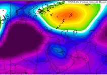
آنومالی تراز 500 در 15 سپتامبر 2014 و خودنمایی بیشتر الگوهای پاییزی

v1x2y6t43a67yswl2lv.png
 

AFSORDE

کاربر ويژه
12-12-2013
12-12-2013

بچه ها دیشب خواب برف دیدم!!!

:138:


دیشب خواب دیدم برف و تگرگ دانه ریز شروع شد و بعد من توی حیاط خونمون خوابم برد (توی خوابم دوباره خوابیدم
:خنده1:
) بعد که بیدار شدم حدود 20 سانت تا نیم متر برف روی دیوارها و روی زمین بود. و بعدش توی خوابم خیلی متعجب شدم!!!
:تعجب2:
چون توی خوابم از خواب بیدار شدم فکر کردم واقعیه!!!:giggle:


:خنده1:


درود دوستان........ :بای: :گل:

باز دیشب خواب برف دیدم، اون برف هم مربوط به زمستان نمیشد بلکه مربوط به همین موقع از سال و ماه شهریور میشد :خنده1:

چقدر زیبا و رویایی بود، خیلی جالب و غافلگیر کننده بود!!! :بغل: مثل خوابی که پاییز سال گذشته دیدم، کاملا به دنیای واقعیت نزدیک بود، :17:


توی یکی از کوچه های روستا بودم که یهو متوجه یکدست سفید پوش شدن کوه های اطراف شدم بعد در حالی که بارش خفیف باران رو احساس میکردم؛ دستم رو کشیدم روی یک دیوار گلی که کنارم بود و متوجه لایه ای از برف شدم که روی اون نشسته بود و بعد همه جا به سرعت سفید شد و من :فرار2:، و مردم متعجب و حیران و.... :giggle:

در مورد خوابی که دیشب دیدم توضیح بیشتری نمیدم! ولی فقط همینو اضافه کنم که آخرش میخواستم بیام توی این تایپک و کلی باهاش پز بدم! و حتی بگم از سال های آینده احتمال بارش برف از مرداد ماه نیز در اینجا وجود خواهد داشت!!! :نیش: که (خوشبختانه! یا متاسفانه!) قبل از اون از خواب پریدم :62:


ولی به هر حال، خوابی که سال گذشته دیدم شاید تعبیرش به نوعی این بود که بعد از 7-6 سال دوباره شاهد بارش برف در منطقه بودیم. :104: آیا از این خواب هم میشه یک چنین تعبیری کرد و میشه نتیجه گرفت که دوران عدم بارش برف در منطقه مرکزی استان به پایان رسیده و میشه به بارش برف در پاییز و زمستان امسال هم امیدوار بود؟؟؟؟ به نظر من که احتمالش هست. :18: شایدم...نه!... :نیش:


طبق اون نموادار بالا هم که ........... :104:


:گل:
 
آخرین ویرایش:

Amir Mohsen

متخصص بخش هواشناسی


بررسی چشم انداز وضعیت جوی کشور در 2 ماه آینده


50.gif

تاریخ : دوشنبه هفدهم شهریور 1393
51.gif

نویسنده : امیر محسن
52.gif

2 نظر


خیزید و خز آرید که هنگام خزانست

باد خنک از جانب خوارزم وزانست

با سلام خدمت دوستان عزیز و سروران گرامی

سرانجام شهریور ماه از نیمه گذشت و خنکای نسیم خوارزم یاد آور شور و شوق خزان دل انگیز و زیبا شد. آری خزان رنگ رنگ از راه رسید و مرزهای خراسان را با نفس روح انگیزش در بر گرفت.


مبحث هواشناسی (1)


مطابق با آنچه که همه ما اینروزها در شمال شرق ایران و خصوصا در شهر مشهد احساس میکنیم بتدریج الگوهای پاییزی در حال تقویت هستند و تابستان گرم به واپسین نفسهای خودش رسیده و چقدر خوب که سر و شکل کلی الگوی نقشه های هواشناسی هم بصورت همزمان بیانگر همین موضوع هستند.

نقشه زیر بیانگر آنومالی ارتفاع ژئوپتانسیل در تراز 500 میلی بار جو میباشد ، بررسی وقوع تغییرات در این تراز به جهت شناسایی سامانه های جوی همواره از درجه اهمیت بسیار بالایی برخودار میباشد. در این نقشه های رنگهای سرد( آبی) بیانگر دامنه کاهش ارتفاع و فراهم شدن شرایط در ستون جو به جهت ناپایداری و رنگهای گرم (قرمز) یعنی نزول و سکون هوا ( شرایط جوی پایدار و بدون بارش).


نقشه آنومالی ارتفاع ژئوپتانسیل در تراز 500 میلی بار 24 شهریور1393
t99kk4xz7fqb4paz592f.png

با این مقدمه ای که در بالا گفته شد به تفسیر نقشه مذکور خواهیم پرداخت :

1- در سرحدات شمالی دریای کاسپین تا نواحی شمال و شمال غرب اروپا مرکز ناهنجاری مثبت ارتفاع ژئو پتانسیل در تراز 500 میلی بار جو دیده میشه که دلالت بر نزول و سکون نابهنجار هوا در نواحی مذکور دارد، پس باید منتظر روزهای خشک و در مقایسه با این موقع از سال گرم تر از نرمال در شمال اروپا باشیم.
این نابهنجاری در بازه زمانی بسیار طولانی مهمان ناخوانده ای برای کشور ما بود که به دلیل اتصال با آنتی سایکلون عربستان( پر فشار جنب حاره ای) تابستانی به نسبت گرم را برای نواحی مرکزی ایران به ارمغان آورد، دامنه این ناهنجاری جوی به گونه ای بود که ما امسال شاهد کاهش چشمگیر بارش تابستانی موسوم به نوع دوم خزری در سواحل زیبای دریای کاسپین بودیم ولی اینطوریکه از شواهد موجود در نقشه بالا پیداست همزمان با عقب نشینی زبانه های آنتی سایکلون فصلی عربستان از فلات ایران زمین ، محدوده شمالی ناهنجاری مثبت ارتفاع در حال عقب نشینی به سمت نواحی شمالی اروپا میباشد که این موضوع به زبانی ساده و قابل درک مرهون ،سامانه کم ارتفاع و سردی هست که از محدوده شمالی دریاچه آرال و از سمت شمال شرق ایران در حال نفوذ به عرضهای پایین تر جغرافیایی یعنی ایران میباشد.
2-آیا شکل گیری الگوی مورد بحث به معنای آغاز بارشهای فراگیر پاییزی در ایران میباشد؟
در پاسخ به این سوال باید خدمت خوانندگاه عزیز وب سایت هوای مشهد عرض کنم : خیر!
علت در این هست که هنوز باید روند عقب نشینی زبانه های آنتی سایکلون عربستان ادامه پیدا کنه تا هم منابع تامین رطوبت مورد نیاز بارش که همانا دریاهای گرم جنوبی( دریای سرخ- بخش غربی دریای عرب - خلیج فارس میباشند، از سیطره سامانه پر ارتفاع فصلی عربستان رهایی پیدا کنند و هم اینکه زاویه نفوذ و با فرود سامانه های کم ارتفاع شمالی و غربی ( ناوه) به غرب خاورمیانه و شمال دریای سرخ گسترش پیدا کنه!
3- در نقشه بالا محدوده ناهنجاری ( منفی) کاهش ارتفاع در حدفاصل دریای عمان و نواحی غربی دریای عرب قابل مشاهده است که این الگو در روزهای اخیر منجر به وقوع بارش شدیدمنتهی به سیلاب در پاکستان گردیده بود.
شایان ذکر است که مشاهده این محدوده ناهنجاری در صورت تکرار و در طی پاییز و زمستان پیشرو تحت هیچ عنوان به نفع بارش کشور ما نبوده و بهترین حالت برای کشور ما استقرار یک مرکز پر ارتفاع در اون نواحی هست که ضمن رطویت رسانی مطلوب به سامانه های غربی منجر به گسترش دامنه بارشها به داخل فلات مرکزی ایران خواهد گردید.
بهر روی با شکل گیری الگوی مورد بحث در ایتم های شماره 1 و 2 انتظار بر این هست که در روزهای آینده و با آغاز ماه اکتبر به تدریج روند بارش ها در سواحل دریای کاسپین بهبود نسبی پیدا کرده و به نرمال این موقع از سال نزدیک بشه که خروجی مدل پیش بینی بلند مدت فصلی CFSV2 هم گویای همین موضوع هست و علاوه بر مطالب فوق این مدل اعتقاد به وقوع ناهنجاری مثبت بارش در بخشهای از شمال شرق و همچنین ارتفاعات کرمان و شمال هرمزگان در طی روزهای باقیمانده از ماه شهریور و همچنین در مهر ماه دارد:


نقشه های آنومالی بارش در روزهای باقیمانده از شهریور ماه​
kr57ciie729wqz53t1.png
نقشه میانگین بارش تجمعی 17 شهریور لغایت 7 مهر​
140zby8t8e9ro2ow.png
نقشه پیش بینی ناهنجاری بارش 9 مهر الی اول آباه 1393​
h12bh87eyh44cnnh47qb.png
نقشه میانگین بارش تجمعی 9 مهر لغایت اول آبان 1393​
i6cs117sgow8n8f5u34p.png
از لحاظ شرایط دمایی در بازه زمانی 17 شهریور لغایت 8 مهر ماه بغیر از بخش هایی از شمال شرق ایران و همچنین قسمتهایی از بلوچستان- کرمان و هرمزگان که دما نرمال و یا با تمایل به کمتر از نرمال دیده میشه در سایر نقاط ناهنجاری مثبت دمایی بین 0.5 تا 1 درجه سانتیگراد گرمتر از نرمال دیده میشود.
2q3ugwfzry85cd95xyek.png
هنوز برای اظهار نظر خیلی زود هست ولی با توجه به سر و شکل فعلی نقشه ها و همچنین با نگاه به وضعیت ناهنجاری دمایی ماه گذشته اینطور بنظر میرسه که امسال هم دامنه نفوذ هوای سرد از سمت شمال شرق ایران یعنی استانهای خراسان رضوی و شمالی به داخل ایران خواهد بود پس در بازه زمانی 9 مهر الی اول آبان 1393 بغیر از استانهای مذکور و همچنین گلستان و شرق مازندران که چشم انداز دمایی در حدود 0.5 تا 1 درجه سردتر از نرمال برآورد میشه، وضعیت دمایی در سایر نقاط کشور نرمال با تمایل به 1 درجه گرمتر از نرمال در میانه مرکزی-جنوبی کشور خواهد بود.​
0g2hwy2i5rl6pl84t1eb.png
توضیح: اطلاعات مندرج در این پست بر اساس آخرین خروجی نقشه های هواشناسی امروز بوده که امکان هر گونه تغییرات احتمالی در نقشه ها و روزهای موعود دور از انتظار نخواهد بود.


آخرین ویرایش:

علیرضا@

New member
استاد امیرمجسن کاش تو نقشههاتون غرب هم نمایان بود.بهرصورت همه ایران سرای ماست.ما دوستون داریم.من ساکن غرب کشورم.استان ایلام.مرسی.اگه مارو هم حساب کنیین ممنون میشیم.
 

Amir Mohsen

متخصص بخش هواشناسی
استاد امیرمجسن کاش تو نقشههاتون غرب هم نمایان بود.بهرصورت همه ایران سرای ماست.ما دوستون داریم.من ساکن غرب کشورم.استان ایلام.مرسی.اگه مارو هم حساب کنیین ممنون میشیم.

درود علیرضا عزیز


حقیقت امر این هست که متاسفانه grid نقشه های ودر بل به همین گونه است و بنده بی تقصیر هستم و مسلما همینگونه است که می فرمایید همه ایران سرای من است و ما هم شما غرب نشینان میهن عزیز رو دوست داریم.

در حال حاضر شهرستان هستم و امکاناتم محدود هست ولی با عین این حال این نقشه رو بعنوان نمونه از اونچیزیکه خودم با مختصات ایران عزیز پلات گرفتم رو تقدیم شما و هم دوستان عزیزم میکنم.

zqvpuxgzuw28y4st7pt.png


یه امید خدا مدل هفتگی اسمبل ECMWF که بصورت هفتگی 2 بار آپدیت میشه رو به محض اینکه بروز بشه با دید کل ایران برای 32 روز آینده تقدیم شما دوستان خوبم میکنم.
 
وضعیت
موضوع بسته شده است.
بالا