-
توجه: در صورتی که از کاربران قدیمی ایران انجمن هستید و امکان ورود به سایت را ندارید، میتوانید با آیدی altin_admin@ در تلگرام تماس حاصل نمایید.
You are using an out of date browser. It may not display this or other websites correctly.
You should upgrade or use an alternative browser.
You should upgrade or use an alternative browser.
مباحث عمومی هواشناسی
- شروع کننده موضوع Amir Mohsen
- تاریخ شروع
- وضعیت
- موضوع بسته شده است.
mahmood600
کاربر ويژه
سلام علی جانمحمود جان اوایل همین هفته هم باید چتر به دست رفت امد کنیم؟؟عایا؟؟
نه فقط ابرناکی و بارش پراکنده ان هم در ساعات بعد از ظهر و اوایل شب ممکنه رخ بده
اصل زمان چتر بدست بودن از روز دوشنبه شروع و بطور متناوب تدوام خواهد داشت و اوج ان روز چهارشنبه و پنج شنبه خواهد بود
havashenas
کاربر ويژه
ما الان باید بارون داشته باشیم ولی متاسفانه فعلا که پیشبینی باران نمیشه
آخرین ویرایش:
havashenas
کاربر ويژه
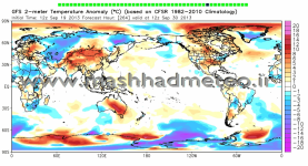
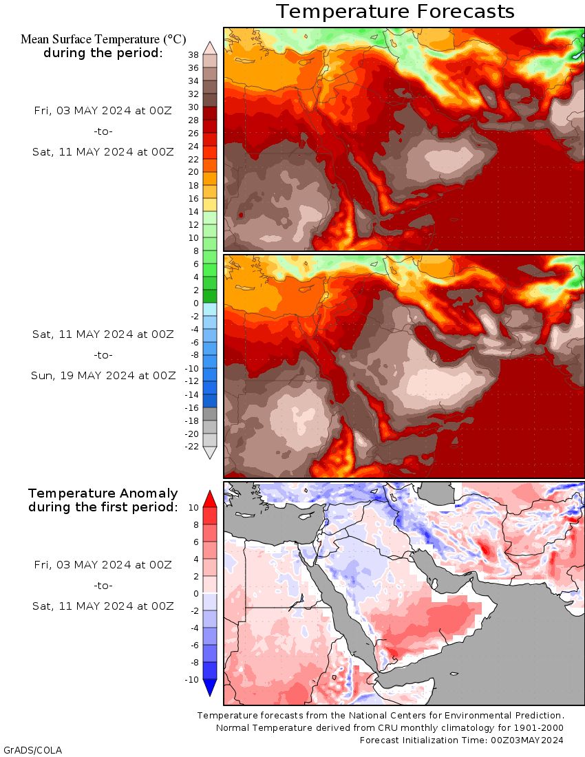
هفته دیگه کاهش دما چشمگیره انشالله:

havashenas
کاربر ويژه
havashenas
کاربر ويژه
بارش برای 192 ساعت آینده:


Amir Mohsen
متخصص بخش هواشناسی
No, Arctic Sea Ice Has Not Recovered, Scientists Say

 By Andrew Freedman
Follow @afreedma
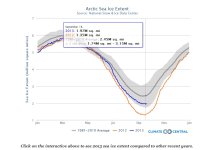
Arctic sea ice extent has likely reached its seasonal minimum, dropping to the sixth-lowest level in the 35-year satellite record. This year’s melt represents a significant gain in sea ice extent from last year — when the ice cover plummeted to a record low — but scientists cautioned that long-term trends are what is most important, with most projections still showing a seasonally ice free Arctic Ocean by the middle of the century, if not sooner. In addition, measurements of sea ice volume are at near-record low levels, indicating that the ice cover is unusually thin and vulnerable.
 Arctic sea ice loss during the 2013 melt season was equivalent to losing the entire area of states from Tennessee to Maine.
Click image to enlarge. Credit: Climate Central.
According to data from September 18, Arctic sea ice extent was about 1.97 million square miles, which is well above the level observed on the same date last year, yet still well below the 1981-2010 average, according to the National Snow and Ice Data Center (NSIDC) in Boulder, Colo. An official announcement of the sea ice minimum is expected to come from the NSIDC within the next few days.
The long-term decline in sea ice, both in terms of the extent of sea ice cover as well as its thickness, is largely due to warming caused by human activities and natural variability, as the Arctic is warming at nearly twice the rate of the rest of the globe.
As has been the case in recent years, the sea ice at the end of the 2013 melt season is unusually thin, which makes it more susceptible to the influence of weather systems. This year, weather patterns in the Arctic were more favorable for maintaining more of the ice cover than during the past few summers, sea ice experts said. But the thinness of the sea ice also indicates that it won’t take much to reach another record low in future melt seasons.
“Basically this summer was a bit colder than we've seen the last several years,” said Julienne Stroeve, a scientist at the NSIDC said in an email interview. “Even though the ice was likely thinner this winter than last winter according to estimates from CryoSat, the relatively cooler summer was able to keep more of that thin ice around.”
Declining sea ice during the summer has spurred a dramatic increase in human activities in the Arctic, including marine shipping and oil and gas drilling. While some of that did occur this year, sea ice clogged the Northwest Passage throughout the melt season, thwarting some planned voyages through the famed waterway that opened for the first time in modern human history in 2007. The Northern Sea Route along the northern coast of Russia did open for a period in September, the NSIDC said
Click on the interactive above to see 2013 sea ice extent compared to other recent years.
For much of the 2013 melt season, low pressure dominated the Central Arctic Ocean and Greenland, leading to cloudier and cooler conditions compared to previous years that had greater declines in sea ice. Average air temperatures were below average over most of the central Arctic Ocean and Greenland this summer, a dramatic contrast to the much warmer-than-average conditions that prevailed during the six previous years.
The summers of 2007 to 2012 were dominated by a weather pattern that helped transport warm air into the Arctic, with a high pressure area over the Beaufort Sea and Greenland, and low pressure over Eurasia, the NSIDC reported.
However, even with the cooler conditions this summer, sea ice extent still dropped into the top 10 lowest on record.
“. . . We still ended up as sixthh lowest, so it reflects that even with a weather pattern that is not favorable for ice loss, you still have low ice conditions — certainly no rebound to conditions in the 1980s/1990s,” Stroeve said. “I suppose if we now had several summers in a row like this one, we could temporarily rebuild the icepack.”
Mark Serreze, the director of the ice center, said observations of sea ice trends and computer model projections show that there can be large year-to-year variability in sea ice extent, which is overlaid on top of the sharp long-term reduction in sea ice cover. “The pattern we have seen over the past several decades is one of a downward trend in September ice extent, with pronounced ups and downs from year to year reflecting the strong natural climate variability in the Arctic. This year, that natural variability helped to preserve some ice. We'll have to wait and see what happens next year,” he said in an email.
“We shouldn't focus too much on the year-to-year variations; it's the long-term trend that is important. All climate models participating in the next IPCC report show that the Arctic will become ice-free in summers as temperatures continue to warm in response to rising concentrations of greenhouse gases,” Stroeve said. “Models also show periods of temporary recovery on top of that overall downward trend, recoveries that can last for several years.”
Walter Meier, a scientist at NASA’s Goddard Space Flight Center in Maryland, told Climate Central that sea ice really didn’t recover much at all, when data in addition to ice extent is considered.
“The long-term trend is still strongly downward, and this year's relatively higher extent will not significantly change that,” Meier said. ”In addition, the remaining ice is quite thin, so there isn't much change in total mass or volume from last year — in other words, the turnaround in mass/volume is non-existent.”
Data from the European Space Agency’s CryoSat mission, has shown a significant decrease in the volume of winter and summer sea ice — a measurement that incorporates ice extent and thickness — during the past three years, possibly to a new record low at this point.
“I would say that this September's sea ice is like September for a lot of baseball teams. Winning a couple games in a row feels good, but it doesn't change the fact they're still way behind the first place team with no chance to make the playoffs,” Meier said.
- Published: September 19th, 2013 , Last Updated: September 19th, 2013

 By Andrew Freedman
 Follow @afreedma
Arctic sea ice extent has likely reached its seasonal minimum, dropping to the sixth-lowest level in the 35-year satellite record. This year’s melt represents a significant gain in sea ice extent from last year — when the ice cover plummeted to a record low — but scientists cautioned that long-term trends are what is most important, with most projections still showing a seasonally ice free Arctic Ocean by the middle of the century, if not sooner. In addition, measurements of sea ice volume are at near-record low levels, indicating that the ice cover is unusually thin and vulnerable.
 Arctic sea ice loss during the 2013 melt season was equivalent to losing the entire area of states from Tennessee to Maine.
Click image to enlarge. Credit: Climate Central.
According to data from September 18, Arctic sea ice extent was about 1.97 million square miles, which is well above the level observed on the same date last year, yet still well below the 1981-2010 average, according to the National Snow and Ice Data Center (NSIDC) in Boulder, Colo. An official announcement of the sea ice minimum is expected to come from the NSIDC within the next few days.
The long-term decline in sea ice, both in terms of the extent of sea ice cover as well as its thickness, is largely due to warming caused by human activities and natural variability, as the Arctic is warming at nearly twice the rate of the rest of the globe.
As has been the case in recent years, the sea ice at the end of the 2013 melt season is unusually thin, which makes it more susceptible to the influence of weather systems. This year, weather patterns in the Arctic were more favorable for maintaining more of the ice cover than during the past few summers, sea ice experts said. But the thinness of the sea ice also indicates that it won’t take much to reach another record low in future melt seasons.
“Basically this summer was a bit colder than we've seen the last several years,” said Julienne Stroeve, a scientist at the NSIDC said in an email interview. “Even though the ice was likely thinner this winter than last winter according to estimates from CryoSat, the relatively cooler summer was able to keep more of that thin ice around.”
Declining sea ice during the summer has spurred a dramatic increase in human activities in the Arctic, including marine shipping and oil and gas drilling. While some of that did occur this year, sea ice clogged the Northwest Passage throughout the melt season, thwarting some planned voyages through the famed waterway that opened for the first time in modern human history in 2007. The Northern Sea Route along the northern coast of Russia did open for a period in September, the NSIDC said
Click on the interactive above to see 2013 sea ice extent compared to other recent years.
For much of the 2013 melt season, low pressure dominated the Central Arctic Ocean and Greenland, leading to cloudier and cooler conditions compared to previous years that had greater declines in sea ice. Average air temperatures were below average over most of the central Arctic Ocean and Greenland this summer, a dramatic contrast to the much warmer-than-average conditions that prevailed during the six previous years.
The summers of 2007 to 2012 were dominated by a weather pattern that helped transport warm air into the Arctic, with a high pressure area over the Beaufort Sea and Greenland, and low pressure over Eurasia, the NSIDC reported.
However, even with the cooler conditions this summer, sea ice extent still dropped into the top 10 lowest on record.
“. . . We still ended up as sixthh lowest, so it reflects that even with a weather pattern that is not favorable for ice loss, you still have low ice conditions — certainly no rebound to conditions in the 1980s/1990s,” Stroeve said. “I suppose if we now had several summers in a row like this one, we could temporarily rebuild the icepack.”
Mark Serreze, the director of the ice center, said observations of sea ice trends and computer model projections show that there can be large year-to-year variability in sea ice extent, which is overlaid on top of the sharp long-term reduction in sea ice cover. “The pattern we have seen over the past several decades is one of a downward trend in September ice extent, with pronounced ups and downs from year to year reflecting the strong natural climate variability in the Arctic. This year, that natural variability helped to preserve some ice. We'll have to wait and see what happens next year,” he said in an email.
“We shouldn't focus too much on the year-to-year variations; it's the long-term trend that is important. All climate models participating in the next IPCC report show that the Arctic will become ice-free in summers as temperatures continue to warm in response to rising concentrations of greenhouse gases,” Stroeve said. “Models also show periods of temporary recovery on top of that overall downward trend, recoveries that can last for several years.”
Walter Meier, a scientist at NASA’s Goddard Space Flight Center in Maryland, told Climate Central that sea ice really didn’t recover much at all, when data in addition to ice extent is considered.
“The long-term trend is still strongly downward, and this year's relatively higher extent will not significantly change that,” Meier said. ”In addition, the remaining ice is quite thin, so there isn't much change in total mass or volume from last year — in other words, the turnaround in mass/volume is non-existent.”
Data from the European Space Agency’s CryoSat mission, has shown a significant decrease in the volume of winter and summer sea ice — a measurement that incorporates ice extent and thickness — during the past three years, possibly to a new record low at this point.
“I would say that this September's sea ice is like September for a lot of baseball teams. Winning a couple games in a row feels good, but it doesn't change the fact they're still way behind the first place team with no chance to make the playoffs,” Meier said.
Amir Mohsen
متخصص بخش هواشناسی
Its no fun if I don't put myself out on a limb so I will try it this year, a preliminary guess now, a better one in 3 weeks and a final one around 11/1. Please forgive the longer post, I have not a blog nor the time to create one with cool and useful graphics like I've seen in others. Take it for what its worth

September 19, 2013 - My preliminary Winter 2013-14 guess
This winter forecast is based upon a blend of long range models seen to date and the fact that ENSO does not seem to be much of an influence, staying in the neutral range (neutral/warm or neutral/cold). Therefore we will be subject more to NAO/AO oscillations and right now I do think that we will see more of the frigid temperatures here in the US rather than Europe this year.
Secondarily it is based upon the autumn continuing on the dry side to allow for lower minimum temperatures, no major late season tropical disturbances to stir the pot, a weak solar cycle coming off its peak, and recovering Arctic sea ice allowing greater chances for cold air to build to the north. I also keep an eye on and interpret trends noted by the very knowledgeable/professional folks on this forum as I am a semipro.
When I say that a month "resembles" another month, I am looking at the appearance (temps, precip, snow, variability) and what it reminds me of, not necessarily the underlying pattern or a true analog year.
The forecast is also centered on my area (S Central PA piedmont west of the major cities) but other areas are mentioned.
Overall - This will be a "more traditional" winter than we've seen lately compared to the high degree of variability we have seen from the 2009-10 snow dump to the 2011-12 torch. Like last year it will be more changeable rather than a full-winter dominant pattern, but be cooler and snowier in all compared to last year.
Winter will not be an early starter like Nov/Dec 1989 but it will not wait until the 2nd half of February like it did this past winter. It will begin about when its supposed to and warm up at about the normal time. Therefore I may see a couple flakes IMBY from a mid or late November cold front but nothing on the ground until early to mid December. I see a winter with mid January to early/mid February being a cold period, multiple chances for smaller-scale snowstorms rather than a couple large blizzards, and changeable conditions mid February to mid March. It will not linger into late March or early April like this year nor will it disappear by the end of February like it did 2 years ago.
November - I do not see any large scale wintry weather in November and am only mentioning it because it can be a wintry month. It will continue drier with alternating cool and warm spells as the pattern that has set up over late August and September holds. In the second half of the month an arctic front could bring in flurries or light snow but no sustained wintry weather or large scale winter storms. The mountains to my north and west could make out a little better with snow.
December - This will be the warmest month relative to normal but gradually growing wintrier as the month progresses. It will not be a torch e.g. 1984 or 2011. It will be the month when we will be fighting the southeast ridge the hardest, especially in the first half to two thirds of the month and any larger storm will be more likely to be a rainstorm.
It may be a frustrating month for snow for I-95 to the foothills with some shallower pockets of cold air sweeping in but modifying before precip arrives although internal and mountainous sections could make out well. I do not see a December 2009 large storm setup. We could be seeing small marginal storms with temperatures close to freezing similar to the last 10 days of December 2012 as we end on the cold/warmer air line - should be snowier in New England where the cold is less transient.
It may remind us more of December 2005 than any year lately, coming at or just above normal temperatures and near to below normal rainfall.
January - Early on it will be much like December but not a full blown winter hiatus with a week in the 60s. After the first week to 10 days a cold northwest flow is likely to become established, with frequent small clipper systems and a lot of dry air. It is very possible for us to see our coldest minimum temperatures since at least 2009 if not 2004 and I believe I will see below zero IMBY for the first time since -3F in Jan '09 especially if we can get a couple inches of snow cover. Lake effect areas should make out very well though toward February some ice may begin to form to start shutting down the machine.
My current thinking is the northwest flow will come to dominate a 20-30 day period to the extent that any larger scale coastal development will stay south or go offshore wide right (the Scott Norwood pattern), but a few moderate storms and clippers could result. The Great Lakes/Upper Midwest will be the core of the cold air but PA will get in on it.
January will be the coldest month relative to normal and should average out to below normal temperatures (near normal at the very warmest) but likely on the dry side, perhaps resembling January 2003 and coldest since 2003 or 2004.
February - For snow lovers in the mid Atlantic this is the month. The first two thirds of February should offer the best chances for coastal development as the northwest flow that had been locked in does more battle with the early spring southerly flow. It could provide several chances for larger nor'easters to form.
In the second half of February milder air begins to infiltrate and our chances of wintry mix to rain start to win out over snow as the core of the cold air starts to retreat, especially in the I-95 corridor. West of the cities it should be a good month overall for snow. Temperatures should be close to or below normal, but precip above. This could resemble February 1994 or 1986.
March - This will not be a torch like 2012 nor will it have steady frigid blasts like 2013. I think the first half will resemble 1987 with large, wild swings in temperatures a few times along with a couple small wintry storm chances before settling down in the second half of the month to a more stable, springlike pattern (but no torch). Temperatures will come out near normal or slightly above overall, with rainfall near normal.
What are the biggest factors that could knock this forecast off the rails?
If ENSO suddenly bounces to strongly positive and stays there - we will fight the southeast ridge much more. The late January to mid February cold I mention will be centered further west in the high plains and we will be on the edge and we are more likely to see rain, although with the southerly flow component more visible it could provide larger coastal storms (a "feast or famine" situation). Chances of a big Nino over the winter are low to very low.
If ENSO goes and stays strongly negative, zonal flow will dominate. The core of the coldest air will stay to the north and chances for large coastal disturbances decreases. It will be on the drier side and oscillating between cool and mild. I think the chances for any large scale swing for La Nina this winter are very low, less than going strongly positive.
If the current fall pattern suddenly becomes much wetter, it will greatly reduce the chances for very low minimum temperatures during midwinter. It may also enhance precip chances in December and early January, although not necessarily snow chances. I give moderate chances right now but decreasing greatly past October 15 if it has not already developed. This scenario includes any large scale tropical disturbance affecting the east coast and north Atlantic, which is becoming more and more unlikely as we pass the peak of hurricane season.
If AO/NAO decides to set up more toward blasting Europe again as it has tended to do the past few winters ,we will come out very close to what we saw in 2012-13 but slightly cooler especially in mid winter instead of late winter. There is a moderate chance of this and I do not think the AO/NAO setup will be consistent all winter, hence the amount of changeability in my outlook.
Amir Mohsen
متخصص بخش هواشناسی
:شاد2::شاد::گل::گل:

havashenas
کاربر ويژه
Amir Mohsen
متخصص بخش هواشناسی
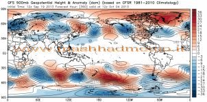
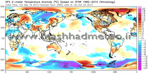
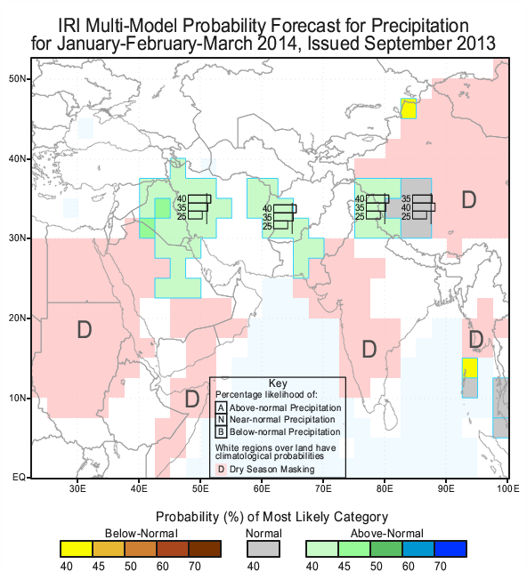
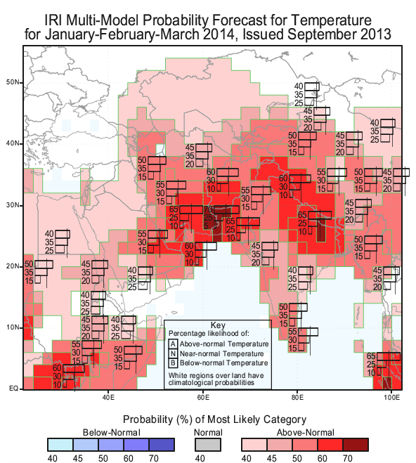
من دما رو واسه زمستون در آپدیت دیشب CFS دیدم خیلی امیدوارکننده بود.
منتهی ناگفته نماند در آپ دیشب دسامبر و ژانویه گرمتر از نرمال بود ولی فوریه- مارچ- آپریل دماههای خنکی پیش بینی شده بود.
منتهی ناگفته نماند در آپ دیشب دسامبر و ژانویه گرمتر از نرمال بود ولی فوریه- مارچ- آپریل دماههای خنکی پیش بینی شده بود.
اما متاسفانه پیشبینی دماییش جالب نیست:
havashenas
کاربر ويژه
فقط من یه چیزی بگم داداش کاری ندارم به نقشه ها نقشه ها بگن نگن زمستان امسال میترکونه چه نقشه ها تایید بکنن چه نکنن بهار هم که بهتر از زمستان انشالله خواهد بود.من دما رو واسه زمستون در آپدیت دیشب CFS دیدم خیلی امیدوارکننده بود.
منتهی ناگفته نماند در آپ دیشب دسامبر و ژانویه گرمتر از نرمال بود ولی فوریه- مارچ- آپریل دماههای خنکی پیش بینی شده بود.
به نظرم سال آبی 92-93 قسمت اعظم ایران ترسالی خواهد بود انشالله.
Amir Mohsen
متخصص بخش هواشناسی
Amir Mohsen
متخصص بخش هواشناسی
فقط من یه چیزی بگم داداش کاری ندارم به نقشه ها نقشه ها بگن نگن زمستان امسال میترکونه چه نقشه ها تایید بکنن چه نکنن بهار هم که بهتر از زمستان انشالله خواهد بود.
به نظرم سال آبی 92-93 قسمت اعظم ایران ترسالی خواهد بود انشالله.
انشاء الله که همینطوری بشه:گل:
Amir Mohsen
متخصص بخش هواشناسی
پرويز رضازاده ( ٢٢ تير ٨٩ ) : افزايش دماى هوا در جهان ، به طور عمده روى کمينه دما اثر گذاشته است و باعث مى شود تا بارش ها در زير دماى صفر درجه به صورت برف کاهش يابد. رضا زاده افزود: از سوى ديگر گرمايش هوا موجب کاهش بارندگى در مناطق حاره اى شده و در برخى از مناطق که نزديک به قطب ها هستند ، شاهد افزايش بارندگى خواهيم بود.
جوانبخت : کاهش سرعت باد در اغلب نقاط کشور، افزایش ساعات آفتابی در سال، افزایش شمار روزهای داغ و خشک و کاهش تعداد روزهای یخبندان از نشانههای تغییر اقلیم در کشور برشمرد.
وی ادامه داد: دمای شب و روز در حال کاهش است که این امر سبب عدم وزش باد، ماندگاری هوا و آلودگیهای هوا در شهرها میشود.
پژوهشگر و محقق دانشگاه علوم پزشکی اصفهان ادامه داد: بر اثر تغییر اقلیم جهانی پیش بینی میشود که بارشهای شدید در کشور به میزان 30 درصد و بارشهای فوق سنگین به میزان 39 درصد افزایش پیدا کنند.
وی ادامه داد: افزایش بارشها در جنوب غرب کشور یعنی بوشهر و خوزستان نشان میدهد که این مناطق در حال پیشروی به سمت اقلیم گرم حارهایی هستند.
سرپرست پژوهشی تغییر اقلیم مرکز اقلیم شناسی : چند سالى ست كه بارشها به سمت انتهای فصل بارش می روند یعنی به جای اینکه بارشها در ابتدای فصل پاییز و زمستان باشند به سمت انتهای پاییز و زمستان می روند و با تاخیر شروع می شوند كه اين از اثرات گرمايش زمين است .
havashenas
کاربر ويژه
خلاصه ای از هوای تکاب در 5 روز آینده:
البته دما رو بیشتر نشون میده و حدود 2 تا 3 درجه اشتباه داره بخصوص در دمای کمینه:

البته دما رو بیشتر نشون میده و حدود 2 تا 3 درجه اشتباه داره بخصوص در دمای کمینه:
Amir Mohsen
متخصص بخش هواشناسی
Amir Mohsen
متخصص بخش هواشناسی
eeeeeeeeeee چه جالب پس امیر کوروش جان بزودی مشهدی میشی شما!!
همون جریان که از بنده خدا پرسیدند اهل کجایی ؟
گفت اهل زنجان!!!!:خنده1:
همون جریان که از بنده خدا پرسیدند اهل کجایی ؟
گفت اهل زنجان!!!!:خنده1:
بهترين زمان براى پيش بينى دى ماه ، آذر است
هوا تا زمستان هزار بار دگرگون ميشه
از الان وضع زمستان را پيش بينى كردن كار درستى نيست
به هر حال دعا ميكنم زمستان پر برفى باشه
امشب گرلفرندم از مشهد زنگ زد گفت هواشناس چه خبر ؟ آدرس وبلاگ اميرمحسن را بهش دادم :خنده1:
- وضعیت
- موضوع بسته شده است.

